Home

Photo: Wildcat Canyon at Starved Rock

Leave a comment

Wildcat Canyon at Starved Rock (c)2033 JScottReinitz

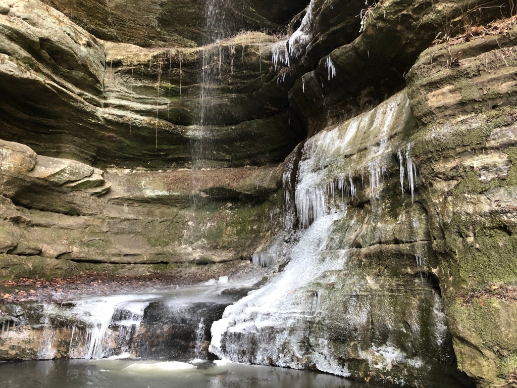
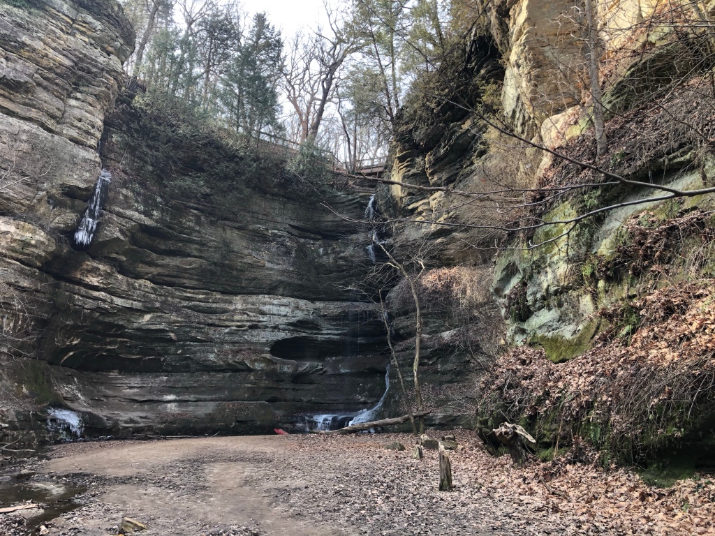
I had the opportunity to take some time off from work (unpaid furlough to save the company money), and decided to go on a short trip to Starved Rock State Park near Oglesby,Illinois.

It is currently Spring Break, and in the Midwest “spring” means “late winter,” so slightly less snow and temperatures around freezing instead of below freezing. We got lucky and got some days in the upper 30s (F) and low 40s.

The original plan was to get a nice place at the Grand Bear Resort (complete with indoor water park) nearby, but we have a doodle, and Grand Bear doesn’t allow pets. I couldn’t see boarding the doodle because she is very hyperactive and I wouldn’t wish her upon anyone. So we opted for a room at a national dog-friendly chain hotel in also-nearby Oglesby, with the thought we could get day passes to the indoor water park.

It turns out the indoor water park at Grand Bear isn’t open most of the week during Spring Break. So, I saved some money there. No big loss, our daughter wasn’t even interested in hopping in the chain hotel pool.

(C)2023 JScottReinitz
Ice melting, Wildcat Canyon (c)2033 JScottReinitz

Photo: Storefront

Leave a comment

1907 Storefront. (C)2023 JScottReinitz

For my first post of the new year, I decided on a photo of a historic storefront. They don’t do stonework like this anymore.

Morning snow hike

Leave a comment

Snow hike etiquette (c) 2022

Photo from our last hike of 2022. We didn’t go too far, just up the Cedar River a bit from Sherwood Park.

Photo: Sylvan Island

Leave a comment

Remains of the Republic Steel Mill on Sylvan Island, Moline, Ill. (C)2022 JScottReinitz

For some 60 years, Republic Steel turned scrap railroad iron into steel for farm machinery. It was located on a peninsula on the Mississippi River that was turned into an island to build a channel for hydroelectric power, wedged between what is now the Rock Island Arsenal and Moline, Ill.

The plant operated on Sylvan Island from about 1890 until 1956. The buildings were demolished a few years later. Nature took it course.

Remains of the Republic Steel Mill on Sylvan Island, Moline, Ill. (C)2022 JScottReinitz

For decades, it was a forgotten chunk of land. In the 2000s, it was turned into a park with trails, bike paths, interpretive signs and a welcome center.

Today, you still see the remnants of the old steel mill —- concrete foundations, sections of walls, piles of bricks and rusting metal fixtures over grown with vegetation.

Remains of the Republic Steel Mill on Sylvan Island, Moline, Ill. (C)2022 JScottReinitz

Photo: Prairie Rider

Leave a comment

Prairie Rider (c) 2022/JScottReinitz

Video: Moon jellyfish

Leave a comment

(C)2022/JScottReinitz

Photo: Jellyfish

Leave a comment

(C) 2022/JScottReinitz

PHOTO: Underground access

Leave a comment

(C)2022/JScottReinitz

Hiking horseshoe trail

Leave a comment

On the Horseshoe Trail . (C) 2022 JScottReinitz

Just off the Mississippi River south of Dubuque, Iowa, the Mines of Spain park offers a range of hiking trails.

One of the more scenic paths is the Horseshoe Trail, which navigates a through the cliffs of a former lead mine.

Horseshoe Trail, Mines of Spain. (C)2022 JScottReinitz

Video: Pond at arboretum

Leave a comment

(C)2021 J. Scott Reinitz

Photo: Palisade Head view

Leave a comment

View from Palisade Head, looking Northeast, toward Canada and freedom. Land in the photo is Minnesota. (c)2021 JSReinitz

While everyone was relaxing at the hotel in Silver Bay, Luna the Adventure Doodle and I headed out to Palisade Head to explore.

The park is a giant rock outcropping/cliff with a spectacular view of Lake Superior and the surrounding shoreline. You can drive right up, and there is a parking lot at the top (and a radio tower).

On the horizon you can make out a hint of land, possibly Wisconsin or Michigan’s northern peninsula — whatever is 130 to 160 degrees from the park. I used my phone’s compass app to take the reading and figured I’d check it against a map later.

Later, we returned with the rest of our adventuring party to share the view.

Photo: Illgen Falls

Leave a comment

Illgen Falls (C)2021 JSReinitz

Illgen Falls is located a few miles inland from Highway 61, up from Minnesota’s North Shore.

The signage isn’t the best, we passed it once and doubled back after realizing we went too far. There is a small yellow sign reading “state park” next to a gravel roadside parking area. Once you stop, you will notice a smaller brown sign reading “Illgen Falls .1 mi” confirming you are at the right place.

Signage and path entrance (c)2021 JSReinitz

A short hike down through the timber takes you to the top of the falls. It’s more secluded, less popular than the other falls along the North Shore. No crowds.

(C)2021 JSReinitz

Older Entries